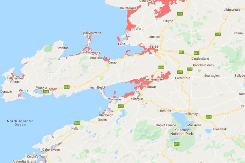
The effect of rising sea levels on Kerry towns and coastal areas will not be as extreme as predicted.
That’s according to Michael O'Shea, a chartered engineer with a PhD in sediment transport monitoring and researcher with University College Cork’s Blue Economy. He was responding to a map which shows many parts of coastal Kerry will be at risk from flooding by the year 2050.
Climate Central, a non-profit based in the US, created a sea level rise and coastal flood map, which shows most of Tralee town could be under water by 2050. According to the prediction, the area from Castlemaine Harbour in as far as Firies, as well as coastal towns and villages such as Ballyheigue, Cahersiveen, Ballinskelligs and Waterville are at risk from rising sea levels.
Lecturer Michael O'Shea says there’s no doubt the climate is changing, sea levels are rising and extreme weather events are becoming more common. However, he says Climate Central’s projections lack local detail and knowledge and adds their maps differ from projections produced by the Office of Public Works.


